‘Location, location, location!’
The Planbureau voor de Leefomgeving uses your IATI data to find out: which development activities are happening in a certain area? And wouldn’t it be better if they were aware of each other?
The PBL Netherlands Environmental Assessment Agency, among Dutch readers better known as the Planbureau voor de Leefomgeving, is a government research institute to support policy decisions around the environment, nature and spatial planning. It has recently used IATI data from all publishers worldwide to gain an understanding on how development projects are converging in landscapes where selected MFA funded programs aim to improve integrated, inclusive and sustainable development. We spoke to Johan Meijer, who is a researcher for the PBL and who ran this project.
First of all: the Netherlands Environmental Assessment Agency, I know that this is a governmental research organisation, but don’t you only work in the Netherlands?
“Ah I see this interview is useful already (laughs). We are an independent organization, and reside under the Ministry of Infrastructure and Water Management, and you are correct in the sense that about 70% of our work is focused on the Netherlands. People might know us best for our research on the Dutch nitrogen deposition problem, tracking of climate change mitigation or the recent reflection on the plans of the new Dutch Cabinet with respect to environment and nature. But, as part of our work program for the Ministries of Agriculture, Nature and Food Quality, and Foreign Affairs, we also work in support of the three UN Rio Conventions (climate change, biodiversity and desertification). That is of course very international in nature, and that’s where the link with the MFA is. Also, the Dutch are good at spatial and landscape planning, and this knowledge is very useful in the development sector.”
So tell me about the research project that involved IATI.
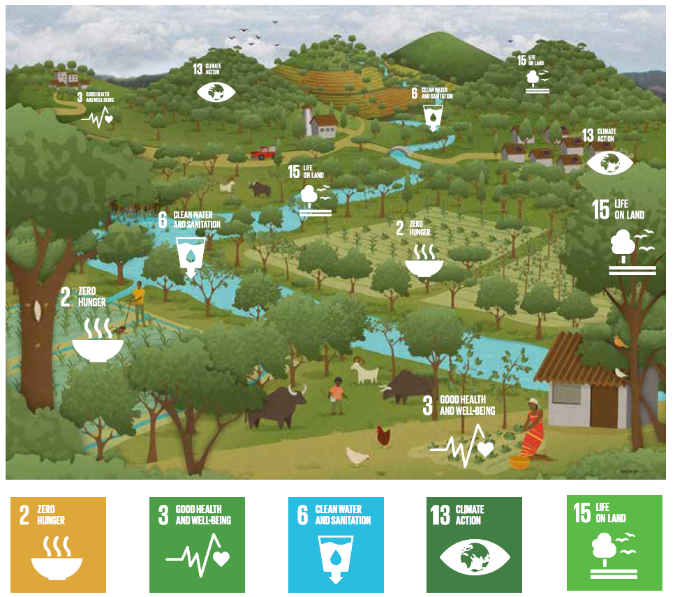
“In 2015, the MFA was getting ready to start some major programmes with organisations that were aware of the importance of a landscape approach: how do activities affect the use of land, the nature in that area, where do stakeholders clash, topics like that. Basically those projects all looked at the balance between people, planet and profit. Initially, we advised on how to bring a landscape approach into various policies, and collaborated with several projects on improving integrated landscape management and stakeholder collaboration.
‘People often know little about which other development activities are happening in the same area of their activities’
But then, we wanted to dig deeper, and we ran into a problem. The landscape approach is all about creating an overall picture of understanding what happens in a certain area. So we wanted to know: what else is happening here? That was very difficult. People just didn’t know. They knew a lot about the context within their own programmes, but often very little about which other development activities were happening in the same or nearby area. Let alone activities by private sector or local government. This potentially leads to missing out on synergies in case two activities work on the same or supporting goals, or could cause trade-offs in case their goals clash.
Also for the MFA, applying the landscape approach proved challenging, because it is organized around themes. Often an individual doesn’t even know what a different section of the ministry or an embassy does in a certain area, let alone other big donors, or multilateral organisations, or smaller NGOs. So we also focused on that question. Let’s say a new policy officer joins the MFA in The Hague or at an embassy – how do we make sure that this person quickly gains an insight what has already happened in an area? So he or she can find out: if I want to do something about a certain issue, it will make the most sense to do this in location X, because I can build on existing work, or perhaps this time I should do something entirely different, or maybe I should do it in location Y because it’s similar to location X but no activities of this type have happened there yet. This could make development cooperation more effective, taking into account the local context and support the ambition to achieve various SDGs in landscapes simultaneously.”
“So it was looking back – what happened in this landscape and who else was working there? – but also looking forward to inform future programming. The new partnership ‘Reversing the Flow’ is one of the activities where this way of thinking is used.
So that was our goal, to create a portfolio of activities taking place in a selected set of landscapes worldwide. But the solution was quite difficult until we found out about IATI. This saved us, because IATI is a central source of information around development aid. We then had to find the right level of geographical data, because a lot of IATI data exists on country level, or even less specific. And the level we wanted, was a certain river basin, or a province, or an area where they produce a lot of palm oil or cocoa. That’s very specific and it could be anything. Last summer we had help from an IATI expert and with his help we found activities that don’t just have country level data, but actual geo locations too. We were pleasantly surprised. It was far from complete, but still about half of all activities published in IATI, worldwide, has geo location data. Then we selected the locations we wanted to focus on, and we had about 25,000 activities left which had been based in ‘our’ landscapes, between 1997 and now. That was a very nice set of data to work with.”
Was there any attempt to improve the data, to ask publishers to add location data if possible?
“No, there wasn’t. We did find some activities and locations manually, by going through the documents linked to the activities which we suspected were relevant. But we couldn’t do that for a lot of activities of course, that’s a lot of work.”
Which other data did you use?
“Other than obviously the locations, we used the organisation names to categorize them, the DAC sector codes and policy markers to explore priorities in landscapes, and if there was SDG information we used that as well. We also retrieved the start-end dates of activities to assess changes in landscapes over time and we played with budgets a bit. We tried to follow the money to see if that was useful. So for example: we have landscape X, and I see that the Netherlands, Germany, and the World Bank all do something in that landscape. Can we take all the budgets combined, and see if we can attribute specific amounts to certain SDGs or sectors or policy markers? But that is still very difficult, especially if you want to avoid double counting. It is all very interesting and in some way promising, but still challenging or even not realistic yet. We are also quite interested in what happens in the current strategic partnerships on results. The basket indicators now used by the ministry may be interesting for us.”
‘Adding relevant location info to your activity would be highly appreciated, not only by me!’
So… any conclusions you can share?
“We are still working on that. Currently, the total number of activities over time, combined with sector information provide already many interesting insights in the dynamics and priorities. Also we have found that in 42 of the 300 landscapes we mapped, there are 3 or more Dutch organisations working on relevant projects. Hopefully they combine forces, but probably not all do. And then there are the other actors in the same area. Integrating between all activities could benefit the efficacy of the activities. Currently, there are still silos and islands, considering also the actors range from small NGOs to large multilateral organisations. Changing that takes effort, but in our opinion, it’s a necessary element in an integrated landscape approach.”
Where can we read more about this?
“There is a website where we collect information on this research. We also have been looking into building an interactive online infographic, but with the intention to stick to the rules regarding government websites and accessibility for disabled people, we haven’t managed to finalize that yet. I think supporting the addition of such reporting and analysis functionality directly to an existing IATI portal could also be a much more robust solution, as in that case the underlying data is always up-to-date!”
Any tips for the publishers? Any requests that would make your life as a data user easier?
“Yes! Location, location, location! (laughs) When applicable, adding relevant location info to your activity would be highly appreciated, not only by me! Also I have noticed that sometimes publishers stopped using policy markers and switched to SDGs, that’s a bit of a shame. Both are very useful categorisations. There is no need to choose between the two.
And I’d challenge everyone to remember Tobler’s First Law of Geography: ‘Everything is related to everything else, but near things are more related than distant things.’ So pay attention to the local context, what are others doing and see if collaboration is possible and fruitful, as that is the foundation for the successful implementation of landscape approaches!”
Want to know more about the work of the PBL in landscape governance and planning, and the results of Johan’s search in IATI data? Check out the website www.thinklandscape.info. There are several reports on earlier work and a new report is nearly done. So if you can’t find what you were looking for now, visit again soon. If you want to contact Johan himself, here’s his LinkedIn.